Feeds:
Posts
Comments

Posts Tagged ‘hiking’

Click this photo for lots more Extra Pictures

I woke in the morning from a dream that I was in a hot tent.  Of course, because I WAS in a hot tent.  We’d agreed to sleep to our limit, after such a long and event filled previous day, but by nine or ten o-clock, the sun had made my tent hot enough to melt butter, and I lurched out of it (extricating oneself from a tent made to roll up as compact as a svelte weasel is never graceful) to a glorious blue skied day.  By the time I attempted a shower (spent 3kr and still got water that was obviously melted off a glacier that morning), and made some breakfast (opened a can or two), the sun had hit Derek’s tent and he was up.

We packed and started out on our hike, buoyed by the blue sky, light warm breeze, and blissful ignorance of what lay ahead.  In fact, our expectations of the day’s hike was entirely based on one paragraph in the Planet, which I will now quote:

The hike starts about 1.5km east of the Básar hut at Goðaland, and then climbs steadily to Mornisheiði, which has dramatic views over Myrdalsjökull, and Eyjafjallajökull.  From here, you face a steep ascent to the ridge and Heljarkambur.  The next stage takes you across tundra and snowfields to Fimmvörðuháls Pass itself, with Myrdalsjökull on the left and Eyjafjallajökull on the right.  The Fimmvörðuháls mountain hut is a short walk off the main track, near a small lake. I used the map gauge to determine this leg of the trip was about 5-6km- a Sunday stroll.

Here’s what it’s really like.

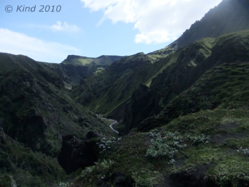
By fortunate luck, Básar was on the same side of the Krossa river as Skógar, our destination.  The first 1.5km, no problem.  The trail sprouting off of the stony river floodbed was clearly marked, and from there, we started climbing steadily, until in twenty minutes we were looking down on where we’d spent the night from a surprising altitude.  Another thirty minutes and the views were truly staggering.  We were very much blessed to have a clear day, and we could see glaciers on either side.   Every few meters of advance yielded new perspectives on the craggy, columnar rock formations, an almost radioactive brilliance of green moss and foliage in the river valleys on either side, and blackened glaciers on each horizon.  We were essentially walking a long ridge, and we did so for a long time.

The going was up and down, and here we got our first true taste of the Icelandic fend-for-yourself ethic.  This was pretty dangerous stuff.  Often, there was a ribbon of pathway at the peak of a very steep sheet of shale that went on for a very long time on both sides. You could preview what would happen to you should you stumble by dislodging a pebble and watching it roll and bounce, accelerating for second after second, after second.  The path would wrap around clumps of rock which you’d have to hug and shuffle around.  Passing oncoming hikers was something you’d plan for after making eye contact with them, choosing a spot to stop where passing was possible.  Only in places of the utmost necessity would there be a few bolts and chains for handholds to grope around a  particularly tight place.

At one squeeze, just passing after a troupe of glowing, smiling girls, we came on a grey-haired man leaning into the convex wall of rock that formed the side of the path at that point, gasping and panting, with the look of having seen a ghost in his eyes.  I was concerned, and solicitous, and my questions or attention embarrassed him.  He made it clear that I should get away from him, and was mortified when he dropped his water bottle, and I picked it up as it rolled away.  He gestured insistently that I leave, so I did, but I was worried, especially after what we had just come through.  How would this man, hiking alone, navigate all that trail that needed good balance, when he could barely stand at this point?

Not just the views were dizzying, often looking at your feet was.  I was pretty comfortable, to be honest, although a good stare down and perspective would get all mixed up, and it would seem that the river valley was rushing up towards you, and it would suddenly seem wise to focus on the path a few hundred feet ahead.

Forgive me for assuming that we had completed the first part, the “then climbs steadily to Mornisheiði”, since we could definitely see two glaciers.  That could not have been more wrong.  Repeatedly we would crest a mountain/hill that had been dominating our foreground, only to descend for twenty minutes then go up again.  As we were obviously following a ridge, we concluded that we must be on to sentence two, until a big mountain face loomed in front of us on the other side of a long mellow descent, with a zigzag traverse climbing to the top.  Aha, the “ascent”.  We sat in the lush meadow at the base of this to eat lunch.  We must have been three hours into the hike at this point, and Derek took some tentative pictures with his camera.

A word about his camera.  Two nights earlier, in the Puffin Fiasco, his precious DSLR got wet.  In spite of a specialty camera bag the length of an arm,  for exactly those conditions, somehow his camera got compromised.  Perhaps water ran down the strap, or some other reason, but the screen clearly showed beads of moisture.  Since I’d killed a camera before by dunking it, on my advice we took the batteries out, cooked it all night on the room heater, and went out and bought a pound of rice to submerge it in.  It looked hopeful for a while, but it just wasn’t behaving right, and it was worrying.

So, all this way, Derek has been packing a camera bag full of rice, packed around his camera in the hopes of pulling the humidity out of it.  “That’s one way of carrying food”, he said.  Eventually, we did eat that rice.

This “steep ascent to the ridge” felt exactly like the hike above Lake O’Hara, a thigh-burning endless staircase, zigzagging back and forth, ever tighter and steeper towards the top, so tight that you couldn’t really tell how close you were to the top.  But from the “summit”, hmmm, this was no ridge.  More of the same, really, ups and downs, only the terrain was much rockier, far less green, and remarkably scarier.  We weren’t passing people anymore, either.   We’d been keeping steady pace with a group of young men that left Básar the same time as us with a guide, but they had left us behind when we stopped to eat.  The trail, if it became ambiguous, was marked by a scrap of carved or painted wood weighed down with stones, and those were reassuring.

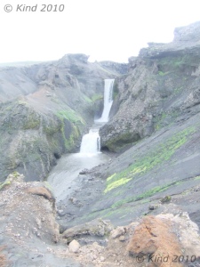
Another hour or more of a long, rather steady descent (this part, to be honest, is a bit of a blur punctuated by pauses to be shocked at the insane unreality of what we were surrounded by, because it was hard),  and we reached an abrupt climb down (imagine a spiral staircase without the stairs) to reach a ribbon of path over two hundred meters long that looked for all the world like the Bridge of Khazad-Dum.  That crossed a gap to a wall of mountain on the other side with a bootpack cut into it that could have been the stairs of Cirith Ungol.  This was definitely Mordor.  We could see tiny figures summiting the other side that we assumed was the guided group ahead of us.  This tiny pathway, the peak of two touching parabolas of grey gravel, was a bridge between two absolutely vast ravines.  On the right, the view stretched out to mist over coneshaped mountains and black ice; on the left, a spectacular waterfall hundreds of meters tall was rushing from the leading edge of a glacier funnelled down into a pinch of black sheer cliffs.  It raged with such amplitude that even from kilometers away, as we were seeing it, the roar was insistent.

About this time I grasped why the old man had looked like he’d seen the Reaper.  He had come down this way!  The only thing reassuring about the climb ahead of us was that this HAD to be the “steep ascent.”  I think it took an hour.  This is the kind of bootpack that you just stop thinking for, focussing all of your attention on lifting your knee again, and making sure, at all costs, that you load your balance forward, so your pack doesn’t pull you backwards.  At times, it was as steep as a ladder, so you could use your hands against the hill in front of you for balance, and there were yards of ropes draped along the upper third to haul yourself up.  The updrafts of the mountain blew at us, and visibility decreased, not that there was anywhere at all to even pause and turn to look around.

At the start of this climb, the path bridge, we were already at such a dominant altitude that it seemed not right for people to be creeping about any higher in the world.  In fact, the top turned out to deposit us on another planet.  For a couple miles, we walked across a snowy, smooth and desolate field of rock and ash interrupted only by cairns and footprints.  It was amazing.  It was essentially the fourth completely different landscape we’d encountered already this day.

I assumed this was the tundra, but I was ready to throw out the book now because there had been no ridge, and we surrendered to simply hoping that we would encounter the hut eventually.  Another significant descent, then ascent, and we crested a hill into yet another colour scheme.  Everything here was a rusty red, a light grey, and white.  The gravel we were walking now was finer, and chalky, and the path was clear as anything , headed downhill.

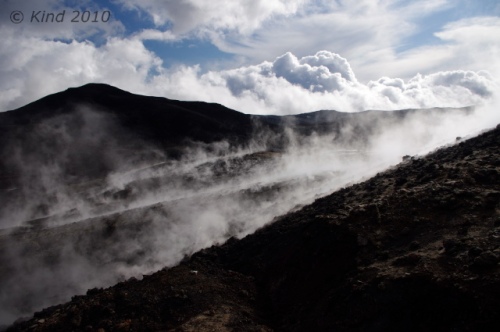
“Check this out!” my brother shouted excitedly.  In the middle of the path, a piece of wood the size of my forearm was anchored by rocks in the middle of the trail.  You had to get up close and squint, but it said “new trail”, and pointed right, where indeed, there was an alternative path curving the mountain we were on.  Then it all became clear.  The old path led straight as an arrow down to where it vanished, obliterated by the half km wide path of lava running perpendicular to us.  White, black, rust red, and still steaming, it was obvious.  We walked the new trail into a new world, picking our way between puffs of steam by following blue-painted sticks of wood that marked the safe trail across the lava.  The ground was warm to touch, but not hot through our boots.

We passed a group who was taking pictures of what happened when they poured water on the ground (for the same experience at home, pour water on a hot woodstove).  In the middle of this lava field, Derek’s camera took its last pictures, and expired, turning itself off with an ominous finality.

The sun was getting lower now.  It backlit hikers climbing the side of a perfectly cone-shaped volcano with a gorgeous sunset glow-the guided group of four we’d been leapfrogging all day, up on top of this small volcano.  Electing to not climb that unmarked trail, we passed them there, and didn’t see them again.

Everywhere we walked, the earth was richly, PEI red, but it wasn’t earth, it was dense, gnarled rock.  Amazing, once again.  My mind was starting to pop with all the new things I’d seen this day, and it wasn’t over.  After navigating the winding path across the hot lava field, we started uphill again, to the right of a bright blue sheet of lake that seemed incongruous in context.  As the sun set, mist settled in on us, and we were really pushing now to make that hut.  Earlier, I had optimistically thought, we could maybe make it all the way down into Skògar.  The book says the hike from Þorsmork to Skògar is “fairly easy”, and “can be done in a long day”, but suggests it is “more enjoyable” to break it up with a night at Fimmvörðuháls.  Nine hours of hiking later, in ideal conditions, in excellent health, no injuries, and average weight load; this was definitely more than 6km, we were starving, and there was no way we weren’t spending the night at this hut.

If only we could find it.  Our surroundings turned into a monochrome field of the strangest pots, as if the cracked surface of a desert fused with muskeg.  My camera, by this time, had gone too long without a fresh battery (two days), and we were turning it on hoping to get one picture on fumes, before it turned off.  No time for dallying with settings.  As far as one could see – these bowls of ash, various sizes, with the surface everywhere cracked as if from dehydration.  Of course, we couldn’t see very far.  The mist had swallowed us, blowing away occasionally just long enough to tell we still had no landmarks.

“There it is,” Derek suddenly said.  The fog blew aside and we caught the briefest glimpse of a house shape perched on the edge of an amorphous mountain.  Very far away still, a good ways up, and a good ways to the right.  The vision floating in the mist reminded me instantly of the Series of Unfortunate Events – the severe house perched on a crag above Lake Lachrymose.

We trudged on, confident now that the hut was indeed still ahead of us.  Another hour, or half an hour- time is very hard to judge when you’re tired and hungry- my confidence had evaporated in inverse proportion to the fog, which got denser and thicker.  We’d hit the top and had been going down for what seemed for far too long.  We almost missed the little sign that said hut, 2km, this way.

Those two km, with about 7m visibility the whole way, were the longest two of the trip.  A constant uphill, often muddling around looking for footprints to find the trail, slogging through snowy, muddy ash looking for the Unfortunate Events house, felt like about five km, as the dusk darkened in on us, too.  Finally, I stopped in my tracks, howled in despair that we were never going to find it, and just like the movies, a cold blast of wind hit me in the face and whisked away the mist in front of us, revealing the hut looming right on top of us, as close as if we were standing on the lawn in front of it.  I had enough time to blink before someone inside gestured to us which entrance we should go to.  Derek didn’t stop laughing for about half an hour.

I think we paid $30 each to share one of eight forty-eight inch bunks in this hut, occupied by 19 other people that night, mostly German, and almost all headed the opposite direction.  We cooked  our dehydrated food packs with melted snow, like everyone else, and we absorbed suggestions from the travellers who’d been here longer.  We learned many things that night from the hut keeper, a man who had hiked down to Basar that day to take a shower and pick up supplies and back.  We remembered him passing us where we’d had lunch.  Speaking several languages always seemingly interspersed, he brushed off his speed as unusual, yes, he knew it so well and did it so often he was like a Sherpa.  But even he was impressed at the 7’ tall Belgian guy who made it in after 10pm, having hiked from Altavatn, all in one day.  Of course, he ceded, the Belgian’s stride would be almost 2:3 to an average man’s, without exaggeration.

The conical mountain we hadn’t climbed was a new mountain, created by the eruption that had destroyed the old trail.  It was a few months old; the lava takes a very long time to cool.  This was just a small eruption – a “tourist eruption”, barely newsworthy for Iceland – very accessible though. He laughed, mentioned the sticks painted blue that marked the path across the lava.  “One day we thought it was safe, we went out and we made the path- the next day we went back and they were all burnt up- too soon!”  he laughed.  He laughed at everything.  He told us about a french hiker who had set her backpack down to take pictures.  “It half burnt up!  Half of everything- half sleeping bag, half mat, half backpack!”  he laughed.  We heard that yesterday’s river had been an anomaly, and that the footbridge we’d seen thrown aside was already reinstalled.

We had covered at least 17km this day.  FYI, Planet, very little of it was “fairly easy”. Of all the trail hikes I’ve ever done in Canada, including 19km and 4000′ of elevation in a day, this was worse.  The detour around the tourist eruption had added some distance too.  The next day, in the light, we would learn we had also taken the longest possible route to the hut, because we couldn’t see the “unmarked” trail.
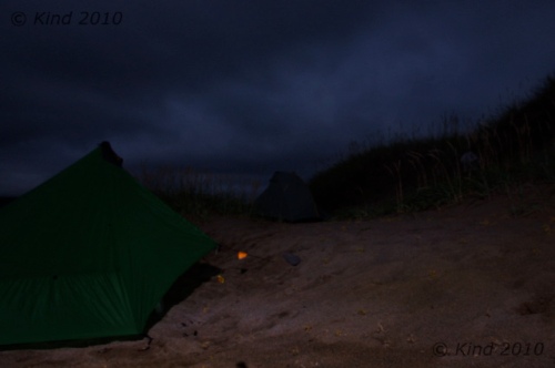
The infamous "last picture", but it was a beauty - click to go to more photos

Read Full Post »


In the morning the full house erupted rather at once.  Notable events of the morning: the hut keeper didn’t recognize me, and was obviously perplexed how I’d gotten into the place during the night without him noticing.  The female occupant of the bunk above ours tried to climb up the wall because I was blocking the way to the ladder (the long table down the center of the hut could either be walked around or sat at, not both at the same time- the space was too tight).  She was using admirable climbing form, and had her feet above her hands before the sideboard she was grasping gave way and she crashed full onto her back to the floor.  I broke her fall a little, and the Belgian snatched a cup of tea out of her path preventing multiple scaldings.  She leapt straight up, mostly embarrassed, but it was a hell of a crunch.  She thought she’d killed my brother I think, but it was just his backpack.

Rustling around all the other hikers trying at once to stuff bags and get awkwardly out the door, we got ourselves packed and squeezed out, chatting for some minutes on the deck with an Icelander who was thrilled to be escorting two American friends over this hike.  The climber girl who had fallen on me, and her boyfriend, in fact.  He rhapsodized about fiskar (dried fish) with butter, and proudly shared some orange flavoured Icelandic chocolate, creating instant addicts out of us.  The morning was clear and crisp, a “bracing” cold, and the mist was scuttling away so we could see where we had been the night before- an expanse of rolling hills pocked with those mysterious pits.  The strange bowls were created by the action of the sun on the layer of ash heating the ice beneath, he explained, and we marvelled at this phenomenon.  He pointed out the path we should take down- one of many threads of footprints spidering away from the hut.  We could see the tracks of a Cat through the ash that must have brought supplies.  He warned us that the first half of the walk down was numbingly boring, and at that we set out into the grey ash desert.

A couple of km down we checked out the “free hut”.  It was a  corrugated iron shack cabled down to bolts in the ground, with an A-frame outhouse heaped in rocks to keep it from blowing away too.  The door opened on an enormous mound of garbage, behind that a filthy plywood floor.  The wind was whistling piercingly through the joints, rattling the windows, and banging the door against its latch.  Not inviting.  We agreed, we were glad we had paid for the Útivist hut.

The Icelander had been right: for a good while the walk down hill was pretty monotonous, following the treads of the Cat, which met a road, which rolled ever onward downhill through this desert of ash.  Slowly, the severe landscape changed.  Green was introduced, and on our right, a creek was making itself known in a cleft that got deeper and louder every time we paused and stepped off the road to look down into it.  Soon it was a foamy, milky rapids, and later, cleaner, with swirls on the surface that betrayed the speed and depth of the water now.  We crossed the river once on a footbridge, and for the rest of the way, the river stayed on our right.  Near that bridge we saw our first fox tracks in the ash, and shortly after that it got green.  Where there’s green, there’s sheep, so we saw lots of sheep and even more sheep evidence on our way down.  The sheep all stared back at us, usually while chewing rythymicly.

Today’s hike was very, very easy.  Going downhill generally is.  It was a steady, gentle slope.  The river beside us, the Skóga, grew larger and fell over a series of falls.  Not little waterfalls, either.  Considering we were descending a moderate grade, it wasn’t logical how again and again, we’d encounter a huge raging waterfall.  An interpretive sign at the end of the road would tell us there were 21 falls on the route we walked this day.  There were at least that many.  The frequent long stairstep falls probably didn’t count.  Unique, gorgeous, calendar beautiful falls, every one!  It was an abundSo terrible.  The battery would get one snap and then turn off- no time to adjust settingsance of beauty that seemed so excessive and extravagant that it became humorous.  Derek started saying “Oh, just another foss” at each, next, extraordinary spectacle.  “Oh, another foss” was something we said with a grin and shrug quite often the whole rest of our trip, as Iceland turned out to be truly thick on the ground with world class waterfalls.  Sometimes we’d hear the roar a ways off; sometimes the sound would be blocked by the land, or we’d turn a corner to discover another, suddenly.  Sometimes the trail would wind to the base of a foss, sometimes you would see one below you from the top of a cliff.  At every one we were just killing ourselves that we had no camera at all at this point to preserve it with, and we’d just pause and stare instead, trying to fix it in memory.  The sound and the mist and the “good ions” made for a very peaceful day’s walk downhill.  It was quite far, but not at all hard.   The nearer we drew to Skógar, the more oncoming hikers we saw, some out for a day hike up the Skóga, some setting out for Básar.

Most of the time we were walking through trenches in the grass that were sometimes hip deep.  The walking trails had compacted down, digging a ditch through the sod.  This turned out to be characteristic of trails everywhere in Iceland.  When they got too uncomfortably deep, a new trail would start right beside it, so in softer places there would be two or three trenches of varying depths with obvious historical order.

Our hike terminated at Skógafoss, a 62m waterfall missed by few tourists, because it’s readily accessible right off the Ring road at Skógar.  We came on it from above, climbing a stile, having a dizzying look down the falls, and at the backs of the gulls circling in the mist and nesting in the mossy rocks.   It was like reentering another world; as a tourist attraction, Skógafoss is very well traveled.  The steel stairs to the top of the foss are a revolving treadmill of steady foot traffic at all hours.  We were grubby, backpacked, and all serene from solitude and exercise.  Who were all these people?  Society has benefits though- we beelined to the visitor’s centre to immediately plug in our camera batteries and eat, as we had budgeted very accurately for food.  In other words, we had none left.  Menu options?  Minimal.  Fries.  Chocolate.

After the recharge, we went back to the waterfall and climbed it again to get some pictures.  Then we got on the road and hitched out of Skógar, headed to Vík. Vík is supposed to be a must-see for exceptional basalt columns rising out of the ocean at Reynisdrangur, and the sea arch at Dyrhólaey, and I really wanted to take this in, but we never did.  Ironically, we ended up passing through Vík FOUR times, but sadly it remained a list item for “next time”.

This time, it was raining, and we lucked out on a really long ride who was going straight through to Höfn, so we did not stop in Vík, but took the ride to Skaftafell.  This super friendly guy who was thrilled to stop anywhere we we curious about to take a picture, and who talked endlessly about the beauty and history of his country as we drove through it, just happened to be former CEO of one of Iceland’s big three banks.  Yep, all in a normal day for him to pick up a couple of unwashed Canadian backpackers in the rain.  He totally resisted my attempts to draw him out on the topic of Iceland’s recent, crushing economic crash, however.

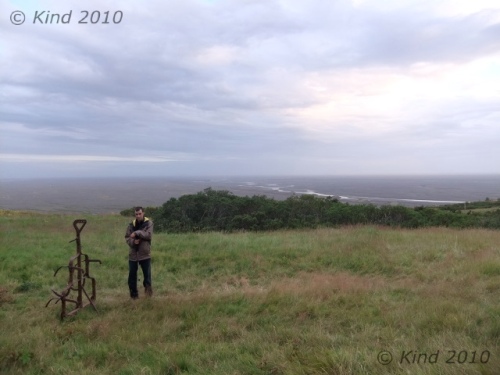
It was hard to grasp the magnitude of the event from ground level, but this drive crossed miles of sandar -devastation created by the jokülhlaup of the 1362 eruption of the volcano Öræfi.  This sandar, Skeiðarársandar, is the largest in the world, a 1000 sq km floodplain of sand deposited by billions of gallons of water released from the glacier by the volcano’s heat beneath it.  Even to say you could see it from space is an understatement.  A smaller but more recent jokülhlaup event in 1996 took out all the bridges across it like they were made of matchsticks (see picture).  When we later saw it from a height, the grey plain is so large that it fades into mist at the horizon, and is totally impossible to take a picture of.  It’s just so big, it’s all that you see, for as far as you can see.

At Skaftafell we were greeted by a huge, modern, bustling visitor’s centre, gift shop, and regimented square acres of green lawn for a campsite, which we promptly set our tents up on, in the shadow of a green mound of a mountain.  Our tents drew comments, based on their resemblance to alien spacecraft.   I didn’t think they were that weird, but I guess, a bit different.  Derek did a  lot of research before buying our tents, based on weight, ease of setup, and packability.  I loved mine.  Derek spent an inordinate amount of time fidgeting with his, usually every night, trying to get it perfect.  Both of them were ultralight, set up pretty quickly, and dried out very fast, which was perhaps the best feature, since every day we’d wake up in heavy dew if not rain.

Tired from the hike, we got showers (cold), didn’t do  laundry (huge lineup), charged all our accessories (“chargers found plugged in here will be confiscated”), and ate in the cafe.  The cafe served coffee, sheep soup, cake, skyr, and junk food, all shockingly expensive.   I stocked up on skyr, cheese, and chips.  My love affair was skyr was just beginning; Derek had already had enough.  We watched the looped movie about the ’96 jokülhlaup, repeatedly.  I kept falling asleep in it, waking up, and then watching it again to see the parts I’d missed, only to nod off again, until i gave up and went to bed.  Well, first: I was craving a hot spring, we were hitting a week here without having been in one, and everyone we talked to was raving about hot spring this and that, so I hitched up the road to a pool noted in the LP that was supposed to be very nice, only to arrive just as they were closing for the night, alas.  It was dull, rainy, and we couldn’t see a thing for the heavy fog, but we were content to crash.

Read Full Post »


I was up with the first sunbeam to a gorgeous, cloudless day.  I jumped on laundry, although making the electronic washing machine work was a bit of a time-consuming challenge, and several other early risers got involved with me pushing buttons, before the thing miraculously came alive.  After that I was a relative expert, and had to start the thing repeatedly for other foreigners.  (Hold this button for ten seconds, then press this one and this one at the same time, then release the first while holding this other one, then wait 5 seconds, then press this one). Really. Or at least it seemed like that.  It was like arcane knowledge passed down between travellers.

I felt blessed to be able to watch the mist coil away from the grass, lift off the mountains and the glacier, to reveal for the first time where we actually were.  I made good use of my Thermarest chair (essential), ate skyr, and made notes in the white space borders of our LP guide, as I was still bereft of my journal.  The ground was drenched with dew and very cold on the soles of my feet, as I made frequent barefoot missions to confirm that the laundry STILL wasn’t finished.  Eventually I gave up and hung all our socks on the bushes and the guy lines of our tents, in good company with all the other campers.  Something is up with their laundry.  The first time I spent $16 and three f@#king hours to do one load of laundry I thought it was anomalous.  The third time it happened,  laundry ceased to be that big a priority.

After leisurely awakening, we decided to spend another night based here, bought new tent tags, then left around 10am for Jokülsárglón, a little further east down the Ring road, getting a ride from a French/Swiss couple with barely enough room for themselves and their gear in the car, let alone us.  But hop in!

Jokülsárglón is another site of stunning beauty easily reached off the Ring road that could be considered a tourist trap.  They definitely process a great many tourists that come for a quick lap in the amphibious boats, a few pictures, and maybe a waffle.  What it is is a great glacial lagoon formed by the ice melt off a tongue of the (inconceivably huge) Vatnajökull glacier, filled with little icebergs calving off the glacier, then drifting slowly towards the sea.  The ocean’s tide backwashes into the lagoon,  so it’s partially salt water, and the seals come in for respite too.

Good tourists, we promptly hopped aboard the next amphibious boat departure, price be damned, which drove into the water and toodled around among the icebergs, preceded by a zodiac there to find a safe route.  A beautiful Icelandic girl in a skidoo suit with a river of blond hair told us in perfect English how quickly the glacier was retreating now, 100s of meters faster every year, but that was ok, because global warming wasn’t happening fast enough for Icelanders.  She held a big chunk of ancient ice with bare hands as she talked, then passed it around for the photo ops and smashed it up on the deck of the boat into little chunks for us to nibble on.  I really liked the amphibious vehicle, and the transition from water to land, as you could feel the engine switch to the axles again and drive out of the water(no one else seemed quite as excited as me so I tried to keep a lid on it).

That was the Jokülsárglón tourist experience.  One can also walk leisurely around the banks of the lagoon and take pictures from the land.  Other interesting facts are that they filmed parts of Tomb Raider and Die Another Day here, and to do so they artificially froze some of the lake, and closed off the lagoon from the ocean (!).

The icebergs are gorgeous: stacked layers of white and blue and turquoise with streaks of black ash, and different degrees of opacity, depending on how the ice was formed in the glacier and the pressures exerted, on how long they’d been in the lagoon and how recently they’d rolled over, and on the vagaries of the sun’s action upon them.  We could have taken 100 times as many pictures here as we did, and Derek’s not having his DSLR hurt.

From the blue iceberg lagoon (time limited offer- will no longer exist in 25 years or less), we inhaled waffles with jam (breakfast was non-existent at Skaftafell, although sheep soup would be reheated later, ten bucks a bowl), and walked across the bridge and the road to where the lagoon really comes out to meet the sea.  Glistening, perfectly clear and intricately sculpted pieces of ice like we had sampled on the boat were washed up everywhere on the ash-black sand beach, looking for all the world like a black and white photo even in colour.  We spent some time here, taking pictures of the millenium-old ice in their last days as ice before returning to water, handling the smooth rocks and waiting for the other hitchhikers to be picked up before we got back on the road.

We got a ride back to Skaftafell with an Austrian couple.  I don’t remember any of it.  I was making a habit by this time of falling asleep as soon as I got in a vehicle or a movie.  It was starting to make me worry.  So weird, but as soon as I put the seatbelt on, it seemed, I was struggling to stay awake.   Still early in a sunlit day, we seized the opportunity to go on a glacier tour.  Only the beginner tour (“Intro to glaciers”), as we couldn’t afford much else.

Before that tour departed, we ran over to see the glacier that we were essentially camped beside, a short walk off the visitor’s centre to the oozing spread of ice reaching down towards sea level, and the canyon it had created.  The plain before it was rugged, scraped and sandy, with some rugged shrubbery, pools and rivers of cement, and an awesome view up over the cracking, pressured ice near the bottom to the expanse of snow and ice that Vatnajökull is.   There’s something about that much ice that can silence you with power.   It’s not silent though, it groans.  All night, it sounded like far off thunder, the ice heaving in the night.

Vatnajökull is vast.

We have some glaciers in Canada.  You can walk around on them and drive on them and even go on a very similar guided tour.  See the rocks that are mossy on all sides, see the cauldrons formed by whirlpools.  But Vatnajökull is larger than PEI (a bit smaller than Cape Breton), the same size as Lake Titicaca, with ice a kilometer thick.  All you can ever see of it at once is one little finger of it reaching between mountain ranges.

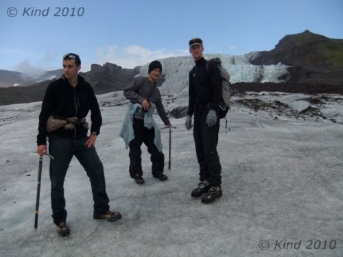
Our glacier tour was really lucky, there were only the two of us plus one crazy Isreali (non-stop clowning around), with our quintessentially Icelandic guide (rugged, blonde, stoic), who was also very indulgent, letting us climb down into any of  the maligns and crevasses, and climb higher and higher on the glacier, although he was really unhappy when we came down to see a family of tourists clambering around on the ice in running shoes.  “I will not rescue you when you fall in”, he spat, disdainful of fools.  On the way home the tour bus even paused at a gas station/grocery store, for us to buy bananas (a miracle!), rice (lifesaving!) and tomato sauce (hallelujah!) for dinner, which the Icelander approved of.  “College food”, he nodded.


We were starting to notice the food in Iceland, or rather the lack of it.  There’s plenty of chocolate and plenty of ice cream, but there never seems to be much choice for veggies and entrees. Between Vík and Höfn (150 miles), there seems to be two places to eat.  The visitor’s centre (sheep soup again?) and the Jokülsárglón cafe.  Waffles.  Delicious, but they’re two mouthfuls apiece; start with three per person.  This was a hungry day.  A person cannot live on skyr alone!  Not at this pace, anyways.

Back at our campsite in the lee of ridiculous vistas, we made rice, and saw the couple who had left us to our own devices at Gigjökull again.  Iceland is a really small world, for tourists at any rate.   Skaftafell is a major hub.  Oh, there’s that other hitchhiker, the one that had the Vík sign (wave); oh, there’s that Austrian couple again, (wave, “Hi!”); oh, there’s the unusually tall Belgian… you see other travellers over and over again at different hikes and campsites, and on the road.

After wolfing down dinner for four between the two of us, we went for a hike up to Sjónarsker.  Buried in the hills above us was Svartifoss, foss of a thousand postcards.  It was a long steep walk down to it (after walking very high up), and along the there were several other unique little fosses- long ribbons, wide washes that fell in steps, and there was a mossy structure that seemed to house a now-disused hydro-electric generator.   This was one of my favourite fosses of Iceland, although it wasn’t all that swashbuckling, considering the majestic curtains of water we’d already seen.  It was just… special.  It was like a cave, the bowl of space that held the fall, damp with mist held in the air and dripping off the black rock.  It’s the black basalt that makes this one so unique, all the columns of hexagonal rock for all the world like a church organ turned to stone. In the river’s spill out, there were piles of boulders, all hexagonal, different lengths, different dimensions, but all black, all six sided, everywhere you looked.  Amazing.

Sandar, as far as you can seeWe lingered around that strangely “holy” pool and its quiet trickle of waterfall for awhile, then carried on up and out of the ravine and across the top towards the glacier again.  This was a profoundly magical place, something I’d only visited in J.R.R. Tolkien’s imagination.  After gaining altitude, we could see over the sandar, the surviving evidence of power on a biblical order, and then we were in a maze of trails and boardwalks through short trees and thick hedgelike bushes.  It was exactly like being hobbits.  I would lose sight of my brother ahead of me, then would see him bobbing along among the twilit green.  The sun started to set in the west, silhouetting the peak behind us and setting the whole sky and the smattering of clouds ablaze in colours that would change by the second.  In the other direction, the setting sun was lighting up the snowy alpine of the mountains beyond the glacier with pinks and oranges and blues that looked fake.  Us, tiny creatures in between, wandered among the shrubs, laid on the moss that felt thick as muskeg, and ate blueberries by the handful, giving up on capturing any of this on camera.

This area is intricate with hiking trails.  I really don’t know exactly where we went, or how far, but we climbed for hours.  The sun seemed to never set, and we just kept going.  Eventually we reached the lip of the glacier-formed canyon of “our” finger of Vatnajökull that terminates at Skaftafell, so we knew where we were.  We were so high here, looking down from the cliff onto the ice, almost small below us, and across the wide canyon at jagged, majestic mountains.  I was seized by an urgent and totally illogical urge to summit Kristínartindar, a conical, steep peak with a clear trail up it,  although it was nearly dark.  It was right there!  So close!  Derek groaned; we argued.  Derek put his foot down and talked me out of it, after I tried to talk him into letting me go alone.  At this point, the sun was well below the horizon, but there was still light, a dreamy, glowing kind of light that seemed to come from everywhere.

I bargained with myself I’d climb here again in the morning (I did not), and headed down with Derek.  About an hour down, and descending started to seem just as hard as the ascent, plus we were in total darkness eventually, with meek headlamps, and it was gnarly.  Wet and slippery, rocky, craggy, and thick with strong, stubborn trees.  By the time we made it back to camp, my legs were jelly.  Sleep hit hard and fast, and the glacier went on thundering through the night.

The Extra photos are really worthwhile for this day: click here

Read Full Post »

Despite staying up with the Northern Lights, we woke at 7am to break camp.  We headed southeast around Snæfellsnes peninsula to approach Snæfellsjökull from the south (again).  On a tightly planned schedule for the day (never a great idea), we made a quick stop at the little (300m) volcanic caldera Saxhóll.  I sprinted to the top, up and down, back on the main road in 15 minutes.  I thought my heart would burst, but it was worth the run.

As we rounded Snæfell from the south in brilliant sunshine- another perfectly gorgeous day- we had to stop to take a picture of the unique ripples in the grey mountain side on our left.  The spot we pulled over had a little path that led to a hollow with a spiral staircase disappearing into the ground!

This just happened to be Vatnshellir, a 100m long cave formed in the lava 8000 years ago.  Access was denied to random tourists without a guide (atypical for Iceland’s tourist philosophy, but probably very appropriate), and the steel silo housing the staircase was all locked up.

We could still see down into the railed viewing hole, and the air coming from it was cold and smelled like winter.
I believe we were near Lóndrangar.

A little farther down the road we stopped for the columns of rock we could see rising from the horizon against the sea on our right.

Walking up and out to the cliffs, we saw an arctic fox running across the field below us, and hung out on the cliff edge high above the surf breaking on the black rocks below us.  Birds were sailing around on the updrafts.  I was already loving the bluntnosed guillemots, ubiquitous but cute and bright white.

  After walking around for some time, perching on the edge, and taking vertiginous birds-eye shots of the birds swooping in the drafts, my brother found a warning on a post.

“Oh, here’s a sign!” he called out.  A little 4 x 4” sign on a post, floating out there in the field of gently waving grass.  Watch out for the cliff!

On to Arnarstapi and the “must-do” seaside walk to Hellnar.  The beginning of the hike at Arnarstapi is guarded by an impressive stacked rock sculpture – Baldur of the Sagas.

As we walked the winding path along the black basalt cliffs (close the gate behind you to keep the sheep out!), we tried over and over to capture the swooping seabirds in our shots.

This place was gorgeous, with the radiating patterns of basalt columns forming caves, ends rounded by the waves.

The sun was shining brightly off the water and the oil-black diving birds clustered on the black rocks, against the deep blue Atlantic and green grass topping the cliffs.

From there we drove up the mountain, stopping en route at Sönghellir, one of Iceland’s singing caves.  This was the most magic place ever, the second place so far that I felt powerfully the magic of the earth.

It’s called a singing cave because of the acoustic resonance, how sounds inside vibrate and shimmer.  I crawled up the curving shelves in the wall of the cave and settled in there, watching tourists below me coming and going without ever seeing me.  Dozens of them strode in, nattering the whole time: “Oh, here it is…It’s not very big…My flash isn’t working…What’s next, honey?”  I was amazed and appalled that they weren’t all struck with awe, considering how the place made my spine tingle and made me want to fall to my knees.  I couldn’t leave, going into the cave again and again, singing, and clambering around the general vicinity until I felt I’d adequately communicated with the spirit force in that cave.

In the parking “lot”/patch of gravel, it was so windy I grabbed the opportunity to dry out our tents that we’d rolled up still wet with dew.  One tent at a time billowed out like a sail and dried in seconds.

The gravel road up to the jökull was a steady ascent in a rust coloured wasteland moderated by moss and lichen.  We stopped several times to take pictures of the developing southward view behind us, and to dry out the second tent.  The view was breathtakingly expansive, of the ocean, that sandar, and a fascinating mountain- Stapafell.

Giants are said to have populated this area in the past, hence the rock monument at Arnarstapi to the last giant, and the cairn atop Stapafell rather corroborates that as a literal possibility.  The spike on Stapafell’s peak looks exactly like the other rock cairns speckling Iceland, but it’s HUGE.  No humans hiked those rocks up there; there’s no way.  I didn’t find any commentary on it, but it’s surely not naturally occurring, and it’s too massive to be human-made.  It’s a mystery.

We were spectacularly lucky to see the glacier at all.  Snæfellsjökull is notorious for being cloaked in clouds 90% of the time, like it was last night.  But the day was still clear and cloudless, and we quickly made the short climb to see the jökull up close – as close as one can without a special guide or pass to get on the glacier.  The ice was close, we could feel it.  Quite nippy on the top of the hill.

Our schedule revolved around catching a twice per day ferry at Stykkishólmur for the Westfjords that afternoon, so we headed down the north side of the peninsula from the mountain with a mission to cover ground quick.  We stopped at Kirkufell to see some sheep hanging out in the low surf and seaweed – clearly sheep are truly everywhere they’re not fenced out of in Iceland, and to pick up our first hitchhiker.  Of course, she was Canadian.  Not only that, but she was from Vancouver, and it took us about four minutes to establish one degree of separation.  So we practically knew each other already, having just met in Nowhere, Iceland.

We had the same destination, Stykkishólmur, but we were headed for the Baldur ferry and she was undecided about going to the Westfjords.   On the drive, we stopped at the “Lonely Planet notable destination” of Helgafell, where you may be granted three wishes if you follow the correct process of climbing the hill to the chapel ruins from the grave of Guðrún Ósvífursdóttir.  This was a lovely, serene place, overlooking green squares of fields.

At Stykkishólmur, we bought our passage on the ferry, Cheryl still undecided, and then sped off for the ultrafast tour of Stykkishólmur.  My credit card decided to work again for the tickets, happily.  Ignoring the problem seemed to work.  We had been hoping to stop in at the swimming pool for a soak and to clean up before heading into the remote Westfjords, but that was out of the question with under an hour before sailing.  We rapidly took in the church, Stykkishólmskirkja, as distinctive as all Icelandic kirkjas, but towering and majestic.  The bell tower was receiving some kind of industrial attention at the time.

We had more trouble finding the Library of Water, but it was worth it.  The minimalist art installation in a former library – I missed the “former” and was expecting art and books – was an irregularly shaped room with two dozen acrylic columns filled with water, and a rubber floor with words stuck on it. 

We had to trade our shoes for very unphotogenic white slippers to walk on the sensitive floor, but the place was a kind of high-brow funhouse, with the columns of water refracting the views out the windows and of each other as we walked among them.  At the last minute we ran (quite literally) out with our shoes untied, leapt back into the car and sped down to the ferry landing again.

Cheryl decided to stay with us for at least a day, and she dashed out to buy her ticket as cars began to roll onto the ferry.   So now we were three.

The ferry was shockingly slow.  For a 25km crossing, it took two and a half hours!  We were not expecting that much time in the least.  I suppose it was an older boat, with a closed car deck that you couldn’t stay on during passage.  Luckily, I snatched my laptop off the car deck at the Flatey stop, and we tanked up on fries and skyr at the cafeteria.  Mid-trip, the ferry docks for a moment at Flatey, a tiny island that you can see the whole of from the boat.  Everyone was crowded around that side of the boat to see the island, and a big ruckus broke out.  The ferry pulled away from the dock to leave, then reversed hard and docked again, as a man dressed like the captain, or maybe first mate, descended from the tower and much hollering burst out in Icelandic.  Nothing was unloaded or reloaded, though, and the ferry departed again.

The Baldur ferry is one of two ways onto the Westfjords – the large northwestern peninsula that looks like the head of the creature-like shape of Iceland overall.  The other way is to drive there, through the neck, which means much purportedly less interesting driving.  The ferry gets you to the interesting parts faster, supposedly, with an Atlantic Ocean boat ride thrown in.  The ride was bracingly windy and salt-sprayed, with a large outdoor deck close to the surface of the water.  It was a gorgeous day – our luck continued – and it was lovely to be outside in the mixture of sun warm and wind cold.

We were heading to the Westfjords to go hiking and camping in the lesser-seen Hornstrandir, the uninhabited nature preserve at the northwesternmost tip.  For this first night, though, we were headed directly for Latraberg,  one of several famous bird cliffs.  We stopped to tank up at the one-pump, last chance station, where everyone else off the ferry was also stopping.  We had to wait for another couple to finish filling before we could, and it turned out they were Canadian too.  After I paid and came back out, putting away my credit card, I heard the next couple pumping gas talking, and they were also Canadian!  All the Canadians we’d met so far on this trip,  all in the same day!  I started talking to them, and she said, “Well, apparently only 3% of all the tourists who visit Iceland come to the Westfjords.  I guess that’s all the Canadians”.

The road out towards Patreksfjorður was another contender for world’s worst road.  Paved with rugged 3” gravel, it was a very slow, teeth rattling ride.  As the road curled around the point and descended into a tiny hamlet of four or so houses, the beach stretched out long and bumpy with grassy hummocks, dotted with a few sheep.  We stopped to watch the sunset and wander on the beach.  As night fell we decided to just camp there next to the road.  The beach was tangled with seaweed, swampy in places, and the sheep were shy.  But the usual Inspirational Calendar sunset bloomed over the water, changing by the moment, and then, as the sun fell, we spotted the most mysterious line of bright pink chunks of light on the distant horizon.

They were bright, they were pink, and most mysteriously, they stayed there, illuminated long after the sun set.  We just couldn’t figure out what they were.  They were too far too see distinctly, on the edge of distance where your eyes throb with the effort of focusing.  But Derek took dozens of pictures and zoomed in on those, and we speculated what they could possibly be.  They must have been ice, to be so reflective.  Icebergs seemed most likely, but the light reflected from them was so strong it seemed they must be bigger than that, and they didn’t move in the least, even as the hours passed.  Someone said “Greenland!” and that seemed like the answer.  We were standing on the westernmost point of the westernmost tongue of land on Iceland, the closest one can possibly be to Greenland while in Iceland, although it’s still 300km away.

Long after we made supper, set up our three tents, and let tiredness close the day, the pink mystery still glowed faintly on the horizon.

We asked over the next few days about the horizon iceberg/Greenland phenomenon, and were told it was impossible to see Greenland, even from the highest point of Iceland, certainly not from sea level.  I frowned at this.  I know what I saw.  After we got home though, Google answered the question for good.  It is indeed impossible to see Greenland because of the curvature of the Earth, but there is an optical phenomenon called a fata morgana, or “hafgerdingar” in Icelandic, that bends light rays in different temperature air, especially in polar regions.

For more photos of this day in Iceland, visit the Extra Photos page.

Read Full Post »

I woke up to a gorgeous open view that was all mine because the others were still sleeping.   The sun had warmed me enough to come out of my sleeping bag, and  I communed with the guide book, planning the future for some time, until the wisps of cloud in the blue morning sky coalesced into overcast, and I woke the others as it began to sock in and cool off.

We drove off from our renegade camp spot at the secret mountaintop location at 10:30.

What to do?  Suðereyri or not?

We chose Suðereyri, and it was bust.  Nothing was open, and it was a weird place.  It looked impoverished, but supposedly it is a progressive model of a green community committed to sustainability and thriving on tourism.

We didn’t see that.  We didn’t see anyone, or anything, interesting in the least, and we turned directly around and left.

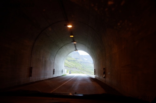
At any rate, it was worth the trip, because the only way to Suðereyri by road is by an amazingly long tunnel bored 5km through a mountain.

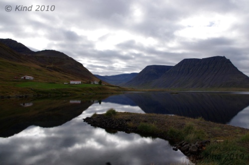
A lovely green view approaching Suðereyri

This seemed astounding.  First of all, it’s the longest road tunnel I’ve ever been in, bar none (five kilometers!), and it seems a  monumentally costly road construction project to connect one tiny town that used to be boat-in.  Also flabbergasting, it has a T-junction in the middle of it.  After driving in the dark for minutes, there’s a T-junction!  Somewhere in the depths of rock under a gigantic mountain, there’s a little sign.  Notifying you: left turn to Suðereyri.  Another wonder of Iceland.

We sped on to Ísafjörður, where we promptly went to the Gamla Bakaríið bakery and ate a lot of bread.  We were near crisis with our camera batteries now, perhaps accounting for the dearth of photos on this day.  Everywhere we went we subtly sought out outlets and plugged our batteries in to snatch a few minutes of borrowed power – at the tourist outlet, the bakery, the library.

Our “hitchhiker” Cheryl was leaving us.  We were destined to go on a Hornstrandir hike, and she had less time left in Iceland than we did and wanted to be more economical.  At the tourist office she investigated flights and we bought tickets for a passage to Latravík at 6pm.  The man there grilled us about our preparedness and experience hiking, looking skeptical and intoning about “cold” until I bristled and said “Look, we’re Canadian, ok.  We’re prepared!”  Then he warmed up.

6pm seemed to allow us tons of time, but as it turned out, it ran out fast.  We took Cheryl to the road to hitch out of town, dropped a load of clothes in the laundry at the campsite, and Derek camped at the library to empty SD cards and charge batteries in preparation for a multi-day hike while I picked up stamps, provisions, and shuffled the laundry.

Laundry is no joke in Iceland.  Unbelievably, our single load of laundry cost $8 here.  To wash.  It cost another $8 to slightly overdry it. For a country with abundant geothermal heat and energy, the cost of laundering is astonishing.  It also takes forever.  I never thought a wash cycle could last two hours.

One $16 load of laundry later, our time had run out, and we were hastily packing our expensively clean clothes into our packs for Hornstrandir.  12 minutes away from 6 o’clock without the food packed yet, we panicked and rushed off to our departure dock at Bolungarvík… and promptly ran into road construction.

Road construction in Iceland – well.  The fend-for-yourself and we-assume-you’re-not-an-idiot ethos is alive and well in this aspect of Icelandic life too.  Clearly, they think flag people are a waste of money, or who could stand to do that job anyway, and cones and pilons must be considered a nuisance too.

We hit construction elsewhere too, and never saw a flagger.  But this was a rather massive operation, over a couple of km, with multiple lanes torn up and the traffic of a pretty busy road diverted.  No signs, no pilons, no flaggers.  That’s right, just traffic rolling pretty smoothly around the big yellow machines that were busy working.  Everyone was working!  I held things up a bit, because  I didn’t know where I was supposed to drive for a moment, but I figured it out.  And I guess that’s what they expect- people will figure it out.  When there’s an excavator sideways in the road, you stop for it.  When it gets off the road, you go around it.  Who needs flagpeople?  If there’s traffic waiting both ways, they work it out, like at a stop sign.  No biggie.  This was totally amazing to me, though, used to a million-cone line marking a lane reduction, flashing arrow signs, temporary streetlights, and flaggers in chartreuse jumpsuits with radios, ubiquitous everywhere there are potholes being repaired in North America.  Where we still have accidents.

We reached the dock at Bolungarvík in the nick of time to find our boat obviously there but no one in sight, thankfully giving us time to pack our food and snack a little.  Someone came to tell us we were departing around 7 instead, so we had time to repack, properly, grease our boots, and mail postcards.

We were the only tourists on the boat with a group of men who stood outside the cabin drinking beer and talking Icelandic.  Their cargo was two bales of insulation, which was really strange and mysterious to me.  I wanted to know, but didn’t know how to ask.  Why were four men taking two bales of insulation to Hornstrandir? That won’t go very far.

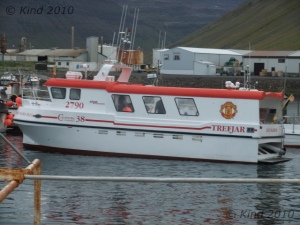
The boat ride in the flat light of an overcast evening put Hornstrandir in perspective real fast.  This was the open ocean.  Although Hornstrandir is connected to mainland Iceland, the fastest way to the eastern edge of the peninsula is by boat, which cuts across the Atlantic much more efficiently than overland.Departure from BolungarvíkThe bow of the boat was bouncing up and down, smacking the waves and throwing spray over the cabin.  Weirdly, the captain of our shuttle would not speak to me at all, directing all his speech to my brother, including his responses to my questions, steadfastly refusing to make eye contact with me.  He would ask my brother questions, looking at him, and then I would answer some of them, and he would continue talking, to my brother as if it had been he who just spoke.  It was a bizarre experience.

I stared out at the waves until my vision blurred, hoping to see a whale.  I saw a spray I was pretty sure was a spout, but it was too far off to confirm.  After the long boat ride, we slowed into harbour, where there was a lone bundled-up woman waiting on the dock to be picked up.  The men with their insulation put out in the zodiac to cross the shallows, then we went.  The boat zoomed off with the woman at the end of her trip, and the men had vanished somewhere as we walked up the beach, alone.

Its hard to describe, but there is no “alone” until you’re alone on an uninhabited island with no phones, radio, contact of any kind.  Hornstrandir isn’t an island, but a 580 sq km area without a road may as well be.  We were scheduled to be picked up after three nights at Hesteyri, a mountain range away.  We were completely on our own until then, and had to manage navigation, food, weather or injury without any back up plans. There are almost no paths, no trails, because the routes aren’t traveled heavily enough to create many.

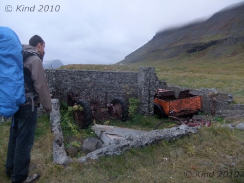
Where we disembarked at Látrar there was garbage everywhere.  Rusty shells that used to be cars and farm equipment, grown-over, hollow foundations, and random buckets and trash almost hidden in the long serrated windswept grass.  We quickly found the emergency hut and curiously checked out all it offered.  There were blankets and candles and fuel and firewood.  There were quite a few snacks and bits of gear, obviously left behind my hikers finishing their hikes for others to use.  We were quite delighted with the emergency hut.

Since 1975, no one has lived on Hornstrandir, and the whole peninsula (the curved “horn”, or a rooster comb, of what I’ve always thought looked like the head of the creature that Iceland’s outline resembled) is a wildlife preserve.  There were several boarded up houses, and we followed the beach line looking for a place to camp for the night.

We chose the sandy bank of the river we’d have to cross in the morning, at the delta where it spilled out into the sea.  Seabirds were gathered on the surfy edge of the water, but they were too shy to let us approach them.

Camping on the sand has never worked out that well for me.  There’s always a humid feel to the air so you wake up feeling damp and wet, and I hate sandfleas.  There’s no purchase for tentpegs, and although the sand promises to dish into a cozy nest shape, in reality it tends to pile up in the wrong places and make a lumpy night’s sleep.  There was nothing but sand, though, sand and sand with coarse grass growing in it, so we chose a spot sheltered by a little dune and sought out rocks to anchor our tentpegs with.

We ate noodle soup and fell asleep on the beach.  It was loud- the waves.

For a few more pictures from this day, click for the Extra Photos

Read Full Post »

We totally got checked out by a fox in the night!

In the morning, there were delicate little prints thoroughly circling our tents.  I thought I’d heard walking in the night but was too tired to wake up and look out.

Gratefully, it was a bright sunny morning and we woke up warm and dry.

We walked up the river and crossed it where it was wide and therefore shallowest.  It was cold, and flowing strongly but smoothly, with a smooth sand and rock bottom, so it was by no means a scary ford.

Contrary to all instructions about fording rivers (always leave your boots on)- and there are good reasons for those instructions – I crossed barefoot.  I spend most of my summers barefoot so my feet are hard and tough, and it was such a delight to be in sand and grass I couldn’t stand to be in my boots.

Then I stayed barefoot for a couple of hours, until we got into terrain full of scratchy bushes, and it was amazing.

Derek thought I was crazy.

Whole essays and poems could be written about the pleasure and reward of being barefoot, but I’ll restrain myself here.

After crossing, we backtracked on the sandy opposite bank of the river to skirt Klief, the fjord in our path, by climbing over the rocks at the sea’s edge.  This was very beautiful, with the black rocks and peach sand.  However, it would not be nearly so pleasant on a stormy day.  After nipping around the base of the fjord we were on another beach (Aðalvík), and we crossed the river at the bottom of that valley and walked up the other side.

We were navigating with a topo map of the area, that had suggested routes and advice marked on it.  Routes are different from paths.  There’s a general direction you’re advised to take, but there are no walking paths worn down by frequent foot traffic.

We walked steadily and sometimes at a fair distance from each other, peacefully walking in the sun.

Our overall route was over the next fjord to Buðanes.  There is another cliff edge route around the base of this fjord, but it is marked as impassable at high tide, which it was.  The map also noted that you’d better move quick even at low tide, or you’ll be seriously f#$%ed when it goes underwater again- I forget the exact wording.   The cliff-skirt route is considerably shorter, but we weren’t nearly on time for low tide.  So it was over the top for us.

On the way we stopped for lunch by a little foss in the middle of the bushy field of blueberries, everywhere.

We encountered some mystery poop, as well.  I can’t imagine what produced this.  It’s still a mystery. Foxes are tiny, and while polar bears are known to occasionally swim over from Greenland, and this scat was pretty huge, it didn’t seem grand enough for the world’s biggest bear, nor likely.  Could it be – a swan poop?

It was a long climb up.  Climbing, or walking, on a trail is a different world from climbing or walking through vegetation.

It wasn’t exactly bushwhacking- the bushes weren’t that tall, but constantly lifting your feet up and over, and the small muscles constantly working to balance your feet as you place them on uneven ground, is fatiguing over time.  It’s about the difference between walking on a sidewalk and climbing stairs.  With nothing in their way on a sidewalk, your feet just swing forward with almost no effort and you can go forever.  Just walking through the scrub was like climbing, and on top of that, we were climbing, and it was steep.

Happily, it was a fantastic day, clear and warm.  Still, we climbed high enough to need to put cozy shirts back on.   It was cold enough for some snow to survive the beating sun at the top.   The snow was unexpected (in August) and refreshing. It was spring snow, grainy and heavy.  We promptly made a small snowman.

Next there was another climb, over the next bump of desolation- the grey wasteland of plateau atop the fjord.  There was a fantastic view, grey and hazy, over ridges of fjords, with the ocean eventually on both sides.  It was a wild feeling to know that literally as far as we could see, there were no other people out there.

Leaving the plant zone and entering the rocky “tundra”(?) was a welcome change of terrain for our legs. We were vague on our exact location per the topo map in such a monochromatic, featureless field of rock, but we were headed down into the next valley between fjords.  We had to go east in order to go west, because there was a clearly impassable area where the topo lines were all squeezed together.  We had a discussion about steepness relative to how close topo lines appeared.  Rather than walking all the way to the east where the route map suggested, I wanted to cut a little bit closer where the topo lines were only “pretty” close together, not “very” close.

So we popped out at the top of this:

As soon as we could see over this, we could mark exactly where we were, and it cleared a few things up.  Topo lines “very” close together means a sheer vertical; topo lines “pretty” close together means very very steep.  Still impassable.

We kept going east at the top of this stone amphitheater, although not as far as the map suggested.  Where it seemed safe we started to zigzag down.  It was crumbly, grainy orange dirt and rock, and it was definitely still too steep for comfort.  We were fine, however, and we saw some interesting birds nesting in the scrub on the way down.

Back into the land of vegetation, here the bushes were very deep, and there were actual walking paths here and there that semed to be formed through the thickest stuff.  Everywhere there were billions of blueberries.  Literally.  All the bushes were heavy with the clumps of blue fruit, and our entire view was carpeted with the reddish green plants.  I could lean on the bank of the trail and stuff blueberries in my mouth for minutes without moving.

Down in the valley with still miles to go to the beach mouth, it was rough going, and wet; swampy.  At the bottom of the valley, there was a pond in a marshy flat that had swans in it.  Exhausted from the day’s hike, I hit the wall, dropped my pack, flopped over and declared we were camping right here.  Everything looked the same, anywhere was as good as anywhere else.

We walked packless to Buðanes for the sunset.  There is an abandoned settlement of houses and a church on the coast, all brightly painted and picturesque.

Some of the homes don’t seem so completely abandoned- locked up and accessorized with modern BBQs and yard appliances; perhaps they are maintained for vacation homes.  It was a beautiful stroll in the late evening light, on winding paths that crossed many streams, to the little vacant town and the beach.  We saw four seals lounging in the bay, and inspected another emergency hut.  Far across the water, we could see Látrar, where we had started from yesterday, and it seemed amazing we had walked so far in one day.

So we started the day on a beach, and finished it on one, at sea level with a monster climb in between.

I slept beside my tent, set up in case it rained.  It didn’t though, so I spent the night outside.  The swans and loons farther down in the bottom of the valley were making an energetic racket, almost loud enough to keep me awake.   Besides that, there was another kind of singing, a subtle, mesmerizing kind, that lasted all night, and in my sleep I knew it was the elves.

For more pictures of our 16th day in Iceland, click Extra Photos

Read Full Post »

I woke up early and almost woke my bro because I could feel rain on the way.  But I was tired so I figured he needed sleep too.  I just scuttled into my tent before the rain started, sure enough.  One can hear so much more when you’re not in a tent.

In the rain I saw a line of swans come slowly down the hill to the pond, chattering away.  It was hard to kept count as they navigated the bushes, but there were possibly 9 little white S-curves behind the big capital S mama swan.

We got a break in the rain to break camp, and then we climbed the east mouth of the fjord valley, skirting the pond. We expected it to be very marshy but it wasn’t bad at all.  It rained most of our climb up the other side.  Already tired, it was a dreary and challenging trudge.  There was no view, because it was socked in, and there was no visual reference for our destination, because it was socked in.

Over and over there were “false summits”, where it appeared we’d finally hit the plateau at the top, but after walking a little farther more hill would loom out of the mist.

We had one Arctic fox sighting, one little brown furball dashing away from our intrusion.

Everywhere there were swans.  Usually there was one bright white couple in each small pond we came upon, but there were two pairs of swans in Teislavatn (sp?).  At the next lake, far up the hill in a pond surrounded by rock, there was another pair of swans.  In their rugged environment and the stinging rain, we dubbed them “back to the land” swans.

Today was hard going and plodding.  Over the top, there was a very long, long flat, on the rocky plain, marked with cairns.  In weather more inclement, they would be nearly useless, but from each cairn we could see the next; the visibility wasn’t that limited.

Our route drifted down towards sea level again after we saw the lighthouse at ? from above.  The rain lifted but the greyness didn’t.  Derek went blazing ahead because bugs suddenly appeared, swarming us like adoring fans.  Most unpleasant was sucking a bunch in on an inhale, something that fortunately doesn’t happen to Justin Beiber.

Over and over we crossed little streams, and the going was very up and down, although overall down.  Here trails began again, and it was very nice to have a trail to follow.  Pathfinding is kind of mentally tiring.

Finally we reached the beach and followed that to the attraction of Hesteyri, an “abandoned” town.

A trudging day. You can see how happy we are about it.

We trekked around, checking out the houses, and were disappointed.  Nothing seemed abandoned nor neglected.  Everything was locked up, well-secured and maintained.  Peering into windows revealed some very attractively appointed houses, that looked so much like they were locked up and walked away from yesterday it was discomfiting.  There was even a guesthouse, clearly equipped to entertain large groups.  There were coats hanging inside doors, boots in the tray, dropped gloves and tools, and food and dishes in evidence.

If this is a place abandoned in the 70’s, then the gnomes run an impressive maid service.

We cooked in the shelter of an old ruined foundation a little way from the “town”, barefoot.  My feet were cold and soaked white and they needed a break from the sopping boots.  A 100% hot meal, with soup to start, tortellini for main, hot chocolate to finish was just the ticket.   I got into dry clothes and we were off to bed at 6pm.  My legs were twitching as I drifted off, achingly tired.  I could feel them healing as I slept, trying to keep up with what I was asking of them awake.

I woke up again at 9, but the fjord was all locked up in fog, so there was nothing to get up for.

For just a few more pictures of this day, click Extra Photos

Read Full Post »

Although I still love sleeping outside, I was ready for a hot pool.

I woke up irritated by the wind battering on my tent.  The sound of it intruded on my dreams until I woke up resentfully, and found that it wasn’t my dreams; the worst gusts of wind were flattening my tent right down to my face.  At least that was unique enough to be interesting.

There was nothing for it but to get up and bag my feet. I was pretty pleased with myself for producing two plastic bags somehow out of my luggage, out of the depleted food supplies no doubt, and I bagged my feet and last dry socks against my sodden hikers.  It was fabulous, however brief.  They didn’t last.  The plastic breached and slowly my socks sponged up water, but it started the day out right.

Alone, I hiked past Hesteyri to the mysterious red brick smokestack we could see past the town, that turned out to be an old whaling station.  I didn’t see any evidence of whales; the carcasses were of big beached iron ovens with rusted bellies and gnarled straps and gears.  None of it made sense to me, but the scale was amazing and impressive.  There were huge warehouse floors, ovens, and the tower was startng to crumble.  Some walls and whole structures were intact, but the roofs were caved in and rotting, and I felt weirdly unadventurous and reluctant to go squeezing into cracks in tumbledown buildings or to go under moss-covered partial roofs.  I trust the manmade much less than natural crevasses and outcroppings.  The trail to the whaling station was varied by bridges and little waterfalls, but I’d brought no camera.

Back near camp I picked some blueberries for breakfast (muesli) and woke Derek.  The wind was bad.  My tent had gotten all wet inside while I was gone and I was bitter about it.  I packed it all and hiked it to the one unlocked boat shed in town, right by the dock.  I finished the complete inspection of the town by snooping on the remaining four houses.  Like all the others, they appeared to be furnished, well-used, and every one locked up tight.

While Derek packed I picked blueberries in the low hills behind the town.  The blueberries were rampant and endless.  The mist was bordering light rain, heavy and dark.  That kind of moisture in the air seems to permeate waterproof clothes.

The yellow shed we sheltered in

It leaks in at your wrists and seems to come inside you with your breath, so it’s impossible to feel really dry although you may not be wet.  At any rate, I was cold.  By the time Derek came to get me I had a big bag of berries and my hands were stiff and vein blue, uncannily like  a corpse.  We went to the dock and hid in the yellow unlocked shed.

Self portrait of waiting

We waited.  We made hot chocolate, we looked around the shed.  We waited.  I can still picture the meagre contents of that boat shed in my minds eye.  A mysterious tool with a snarl of cable, nails and buckets, rags and old sacks, shreds of rope on the ground, oars and worthless warped lumber stacked on the rafters.  We were too cold not to stand, so we stood, stomping and clapping and occasionally mustering enough energy to shout and jump around, which didn’t really help too much.  Occasionally we laughed with a moment of objective perspective of us, hiding in a boathouse.  Mostly we stood staring numbly out at the long dock pointing into the bay, listening and longing for the boat that was coming to get us to appear out of the fog in the bay.

The boat was two hours late.  No zodiac this time; it could pull right up to the end of the long dock built far out into the deep enough water.  It dropped off two guys that had more luggage than I would think possible.  Boxes and drybags and backpacks, all impressively packaged gear, piling and spilling all over the dock.  They were rushing around, tossing and grabbing and hustling their stuff around at a near run.  I was soporific with our long hypnotizing wait in the boathouse, and dazed by their pace and the quantity of their stuff.  Probably the equivalent of six of our backpacks for each of them.  They tersely responded to my conversational questions that they were staying on Hornstrandir for 10 days, and continued barking at each other in German (I think), and hustling their gear around.   In fact, by the time we were on board, they’d moved their giant colorful pile of gear to the end of the dock.  It’s still a mystery what they doing with all that stuff.  Obviously it wasn’t just ten days of food, so they must have been up to something specialized, but their gear didn’t give away what.

The boat was two hours late.  No zodiac this time; it could pull right up to the end of the long dock built far out into the deep enough water.  It dropped off two guys that had more luggage than I would think possible.  Boxes and drybags and backpacks, all impressively packaged gear, piling and spilling all over the dock.  They were rushing around, tossing and grabbing and hustling their stuff around at a near run.  I was soporific with our long hypnotizing wait in the boathouse, and dazed by their pace and the quantity of their stuff.  Probably the equivalent of six of our backpacks for each of them.  They tersely responded to my conversational questions that they were staying on Hornstrandir for 10 days, and continued barking at each other in German (I think), and hustling their gear around.   In fact, by the time we were on board, they’d moved their giant colorful pile of gear to the end of the dock.  It’s still a mystery what they doing with all that stuff.  Obviously it wasn’t just ten days of food, so they must have been up to something specialized, but their gear didn’t give away what.

The pilot was the same driver as before, so needless to say he completely ignored me and spoke only to my brother.  The sea was rough, which made it very fun.  The prow of the boat heaved up and crashed  down on each wave, rain pelted the windshield and it was wild and noisy.  I played at standing on one leg at a time as long as I could in the middle of the cabin.  No one noticed.  The driver rattled on and on about “shelter” and finding the “right path” for the least turbulence.  I suggested we could go faster, and was ignored.

Back on land, we shucked our wet backpacks into our car and drove directly to a gas station.  In the washroom mirror, my face was dirty and my skin coarse.  The weather was more clear immediately. Back in Ísafjörður, we went on a binge of erranding.  A pile of food at Bónus, then back to Gamla Bakaríið for pastries and bread.  I was on the hunt for some light, simple sneakers.  My hiking boots were the only closed shoes I’d brought and I thought I could get by with them everyday, but these days it seemed they never got a chance to dry out completely, and wet heavyhikers were getting tiresome.  There was an ideal thrift store upstairs from the Bónus, but we could only gaze wistfully at the treasure trove of chaos behind the glass, as it was closed that day of the week.

At Hafnarbúdin, I declined to pay $100 (on ütsala – sale) for a pair of cheaply made $30 shoes.  Such is Iceland.  Hopefully, you’ve brought you everything you need, lest you have to buy something there.

Next we discovered the best souvenir shop, the Viking (Víking?), a chain shop.  It was staffed by a remarkable woman with a surprising UK accent.  The prices were relatively reasonable too; by this time we were adjusted to the gaggingly high price levels in general in the country.  The only customers in an oasis of kitsch, handverk (crafts, did I need to explain?), and brilliantly designed woolens, we piled things on the counter and ticked off nearly our entire list of people to bring back gifts for.  Feeling very successful with a big yellow plastic bag, we carried on Vin Búðin (“the wine shop” – Icelanders are literalists).

A friendly staffer whose name I was delighted to see was Snorri, gave us the lowdown on Brennivín.  The green plastic bottle with the striking black and white label is considered Iceland’s signature spirit.  While we were purchasing several to try out and bring home,  Snorri told us that it was cheap, trashy liquor, flavoured with caraway, and that many people died of the drinking of it so it came to be called “black death”, and had been packaged at one time with only a skull and crossbones.  The tense was a little unclear.  It seemed more past, when in harder times gone by more people were “dying of drink”, while in the present, it is considered a low level choice, but unique to Iceland, therefore a source of pride.  Iceland’s bottom of the barrel booze, in other words.  Sold primarily to tourists, it seemed. There were also lots of local beers and cider for sale singly, so we loaded up with an assortment of creatively designed cans for the road.

With that bender of shopping complete, counterbalancing a few days outside of civilization, we drove on.  At Súðavík, we stopped at the Arctic Fox Center, which was tragically closed.  I’d been so looking forward to it.  They had an inviting cafe, too, and posters outside cheerfully explaining how polar bears sometimes make landfall in the Westfjörds after swimming from Greenland and get shot for their trouble.   In the yard, though, there was a large enclosure dusted with seagull feathers around a fox play structure with one fox puppy (I know, a kit) with a big brush tail.  He totally made the stop worth it, he was such a photogenic and entertaining little fellow, not cringing or shy at all.  We lingered, taking lots of photos trying to capture his ultra-quick pouncing and smiling at his antics.  He was such a wild being.  Very primal somehow, and outside of the human world, especially in his eyes.

Can you see the truck on the other side?

The road east of Ísafjörður and Suðavík stays low in elevation and follows the coast, “fjörded” like the teeth of a comb.  For several kilometers, you drive south, pointed inland, while across the narrow finger of water you can see the next car ahead of you about 10km, driving the opposite direction.  At the “bottom” of the bay, you make a short turn and then drive several kilometers towards the ocean and the North Pole, while across the water you can see the road you were just on and maybe a big truck, the next vehicle behind you.  At the tip of the fjord, you turn again and repeat.  There’s the same car on the other side, still about 10 km ahead.  Repeat.  Repeat.

As the afternoon faded, we drove past Hotel Reykjanes and then turned around for it, deciding it was late enough to stop.  It was a strange looking place, a conglomeration of white cubes in the middle of nowhere, but it was perfect.  The owners were sweet and generous, and we paid (quite low) camping fees to tent on the big lawn in front of the buildings.  I produced a giant bag of laundry, and got taken into the basement and told all about how there was a problem with the breaker and the husband was working on it.  His tools were scattered around.  No charge for the laundry!

Their big square hot pool was about the size of a community lap pool (50m!).  It had a deep end and everything, but it was hot, clean water.  It was the perfect temperature to lounge in indefinitely, especially after days of hiking.  All the space to myself, I rested and stretched while steam rose off the water while the sky gently changed colours getting ready for the sun to set.  My brother stalked the sunset with camera, and it delivered another wild one.

For the first time, I had wifi in my tent, which was such a novelty that I had to stay up to 1am on the internet.

For a whole whack of fuzzy little Arctic fox pictures, click here.

Read Full Post »